THE ATLAS THAT REPLACES YOUR GPS

5 REASONS WHY SMART ROAD TRIPPERS ARE DITCHING GPS AND GRABBING THIS ATLAS BEFORE THEIR NEXT TRIP

★★★★★

4.8 Stars — 10,000+ Verified Reviews

Phone showing no signal while navigating with an atlas open in the car

Reason 01

YOUR GPS GOES BLIND EXACTLY WHEN YOU NEED IT MOST

It always happens at the worst possible moment. You're deep in a National Park. The cell signal drops. The app spins. And then — nothing. Just you, your car, and a road you've never seen before.

Thousands of road trippers have been there. One driver spent an entire day on logging roads in a remote National Park in the middle of winter, no cell service, GPS map frozen on screen — barely making it out.

This road atlas doesn't need a signal. It doesn't need Wi-Fi. It doesn't need a battery. It works in every dead zone, every mountain pass, every stretch of highway where the cell towers are just a distant memory. Smart travelers keep it close so they're never at the mercy of a frozen app.

★★★★★

Never Stranded Again

“We lost GPS signal for three hours driving through Glacier National Park. Thank God we had this atlas in the back seat — it literally saved our trip. I will never road trip without it again.”

ReviewerSarah K., Oregon

Reason 02

GPS IS ROUTING YOU THROUGH PLACES YOU DON'T WANT TO BE

GPS apps are built to find the fastest route — not the safest one. That's why they'll happily send you through high-traffic urban corridors, unfamiliar neighborhoods, and roads that shave 5 minutes off your ETA but add 45 minutes of stress.

With this atlas, you choose the route. Full two-page state maps let you see the entire picture at once — where the interstates run, where the scenic byways branch off, and where you might want to avoid altogether. No algorithm making decisions for you. Just you, in control of your own trip.

★★★★★

I Plan My Own Route Now

“Google Maps sent us through a sketchy detour at 11pm trying to save 4 minutes. Never again. This atlas lets me plan my own route the night before and actually know where I'm going. Total game changer.”

ReviewerMike D., Texas
Traffic jam with phone rerouting on the dashboard
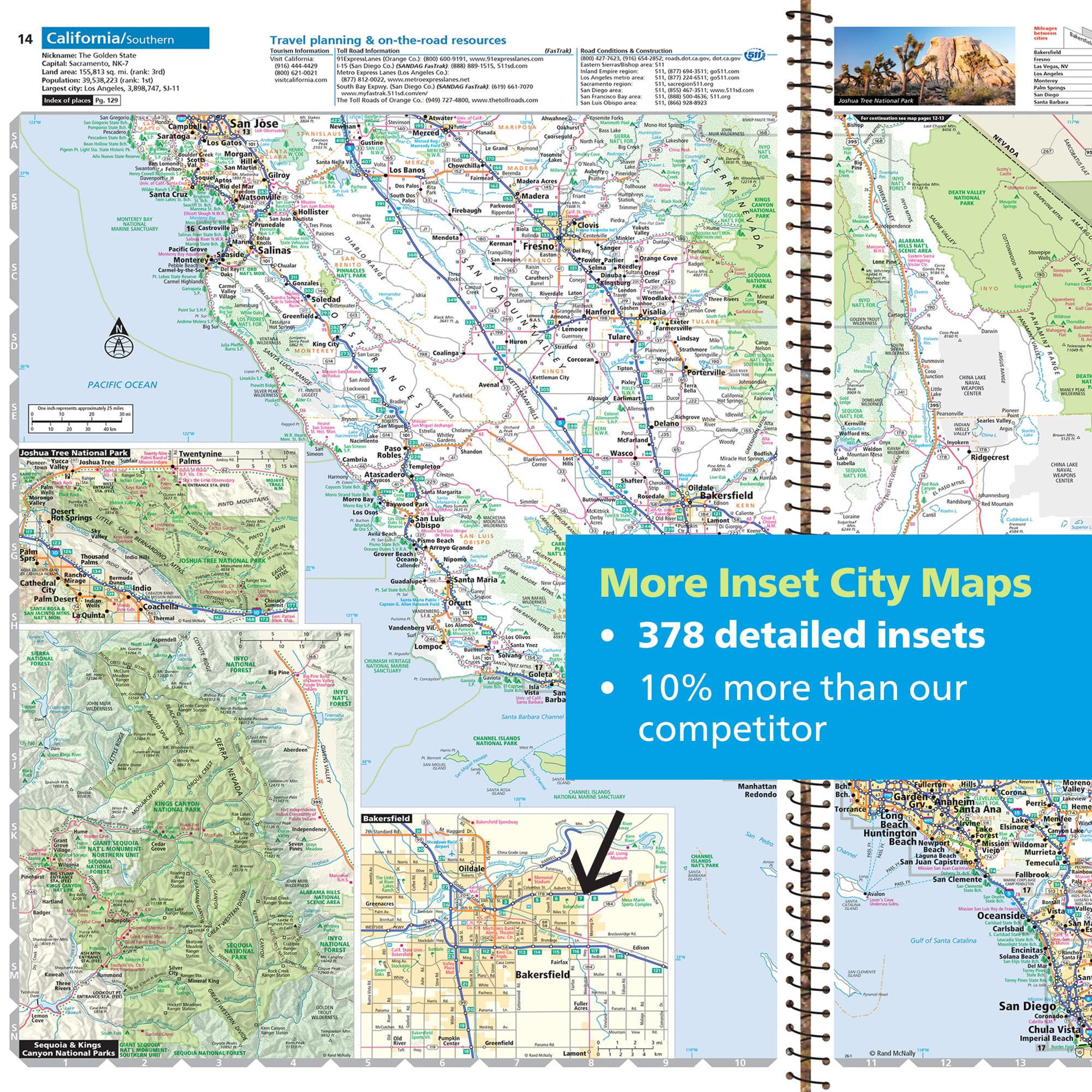
California road map spread with 378 city inset maps

Reason 03

A 6-INCH SCREEN IS NO WAY TO PLAN A CROSS-COUNTRY ADVENTURE

GPS navigation is designed for the next turn. Not the next 500 miles. When you're planning a real road trip — the kind that crosses multiple states, hits National Parks, and builds memories — you need to see the whole picture.

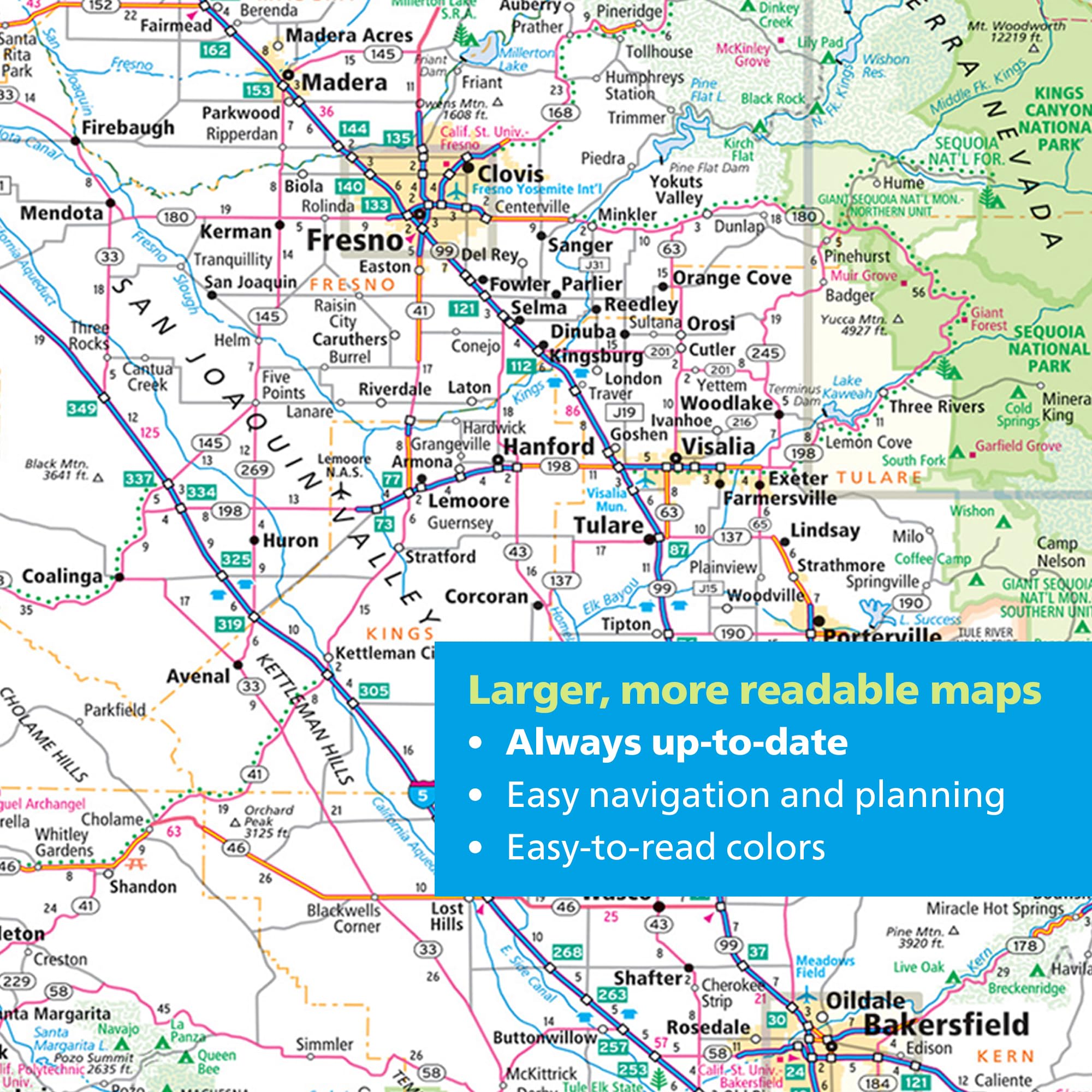
Zooming in and out on a phone for an hour isn't trip planning. It's a headache. This atlas gives you minimum two-page state maps with vibrant, color-coded roads big enough to see without a microscope. Lay it across your lap before you leave. Map out your entire route in 10 minutes. Watch your kids lean in and start tracing the highways with their fingers.

That's not just navigation. That's the road trip experience.

★★★★★

The Kids Were Glued To It

“I bought this for a cross-country trip with my grandkids and they were glued to it the entire drive. The size and detail are incredible — way better than squinting at a phone. Best $40 I've spent in years.”

ReviewerRobert H., Florida

Reason 04

IT COVERS ALL 63 NATIONAL PARKS — IN DETAIL NO APP CAN MATCH

Planning a National Park visit online is an exercise in frustration. You're bouncing between the NPS website, Reddit threads, travel blogs, and recreation.gov — just to figure out the best time to show up and what's worth seeing.

This 2026 atlas dedicates 133 full pages to all 63 National Parks. That's 2 to 4 pages per park, 379 full-color photos, and everything you need to know about the best times to visit, weather patterns, must-see sites, and local activities — all in one place.

For comparison, the National Geographic Adventure Atlas covers only 24 parks. This covers every single one.

★★★★★

Everything I Needed In One Place

“I used to spend hours across five different websites just planning one park visit. This atlas has everything — maps, lodging, best times, activities. I don't know how I traveled without it.”

ReviewerLinda M., Colorado
National park detail spread with large map and editorial layout
Road atlas comparison chart showing 274 pages vs 169

Reason 05

IT'S UPDATED FOR 2026 — AND BUILT TO LAST

Some people still have the same atlas from 2012 rattling around in their trunk. Roads change. Parks update. Names change.

The 2026 edition was rigorously updated by an in-house U.S. cartography team — capturing the latest road changes, detours, park regulations, and updated geographical naming conventions. It's not your grandfather's dusty atlas.

378 city inset maps. 274 pages of coverage. Every state, plus Canada and Mexico. And unlike a subscription app, you own it forever.

★★★★★

Actually Up To Date

“I specifically bought this because my old 2018 atlas was outdated. This one even has the updated geographic naming conventions. It's completely current and the detail is incredible.”

ReviewerJames T., Arizona

YOUR PHONE FAILS. THIS ATLAS DOESN'T.

When the signal drops and the battery fades, this atlas keeps the trip moving. Open it up, see the whole route, and travel farther with confidence.

THE ATLAS THAT CHANGES EVERYTHING

ROAD ATLAS & NATIONAL PARK GUIDE 2026

United States, Canada & Mexico — Works Without Signal. Updated for 2026. All 63 National Parks.

$99.99 Only $49.99
Road atlas and national park guide cover
Large, more readable map spread
Road atlas comparison chart
National park map detail spread
National park guide spread with unmatched park detail
Inset city maps spread with more detailed planning resources
★★★★★

4.8 Stars — 10,000+ Verified Reviews

GET THE ATLAS →
Road atlas and national park guide cover
Road Atlas & National Park Guide 2026
$99.99$49.99
🛒 Get the Atlas